Mapping Water Layers with Georadar
Mapping Water Layers with Georadar allows farmers to detect layers of water in subsoil.
Key Facts
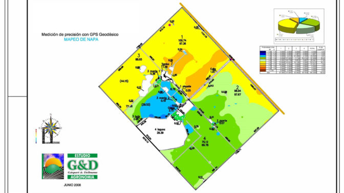
- Mapping Water Layers with Georadar provides a georeferenced map showing the depth to water in subsoil.
- The solution produces a georeferenced map so the farmer can carry out a differentiated agronomic management.
- The solution’s map ensures the quality and yield of crop.
- Estudio G&D developed a satellite image platform where the farmer can enter and see the health status of his/her crops.
- The early identification of problems, when detected, can be controlled avoiding a decrease in yield.
Key Features
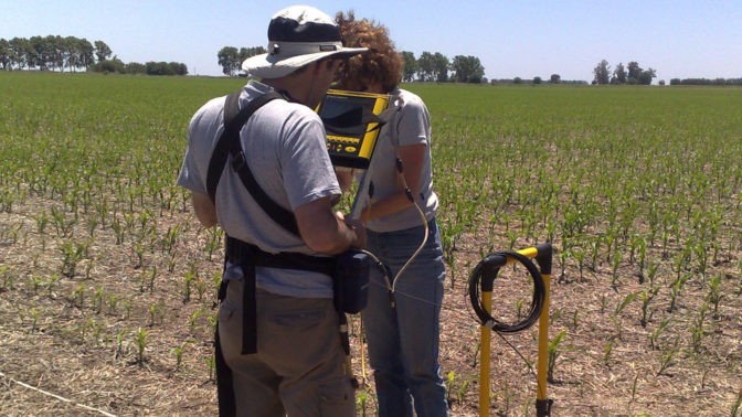
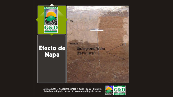
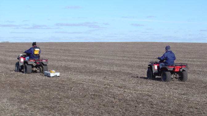
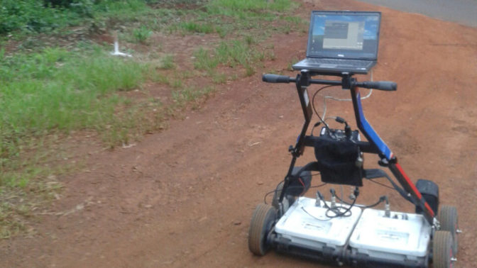
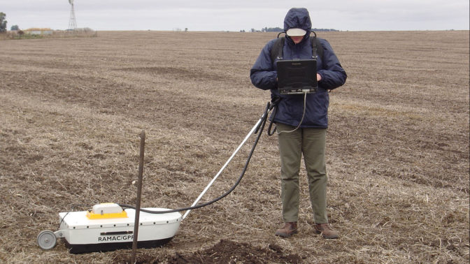
Our development allows us to detect layers of water in the subsoil, to know their location and the amount of water available. The information generated by being georeferenced allows its visualization as a georeferenced map, with the depth to the water, so the farmer can know the environment in order to carry out a differentiated agronomic management, between the area that has water in depth and the area that only it gets water from the rain. This map ensures the quality and yield of the crop, making the most of the water available in this layer.
Social Impact
Agriculture within low-income populations or in poor countries, generally applies low levels of technology, making productivity low and resources underutilized. The knowledge of the presence of water in the subsoil, thanks to this technique, gives the producer a tool to plan their cultivation in a smart way. It is proven that the yield of crops depends on the amount of water that passes through them and thus generates an increase in yield. Knowing how much water is available, we can plan our planting in such a way as to maximize the use of water in depth, increasing the yield of the crops and generating more food for these populations.
Future Plans
Our plans are to advance digital agriculture technology, allowing us to reach more farmers with small infrastructure. For this, Estudio G&D developed a satellite image platform where the farmer can enter and see the health status of his/her crops and thus be able to determine quickly and early if there is any problem to be treated and corrected. Digital agriculture improves the quality of crops thanks to the early identification of problems that, when detected, can be controlled avoiding a decrease in yield.
Main Target Group
Farmers.
Main User
Agricultural Companies.